|
|
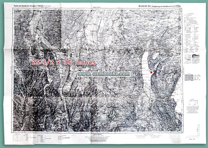
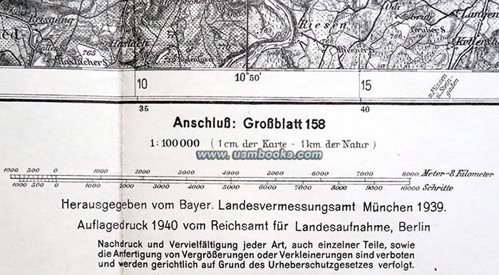
This is a wonderful example of the one-sided black & white, 25-½ x 35 inch Reichskarte of the area west of Munich, as published by the Reichsamt für Landesaufnahme (Nazi State Office for Geological Surveying) at Wilhelmstrasse 9 in Berlin in 1940. The scale of this Reichskarte or State Map makes it the perfect type for use by anyone researching anything to do with the geography of the area west of Munich as one centimeter on the map equals one kilometer.
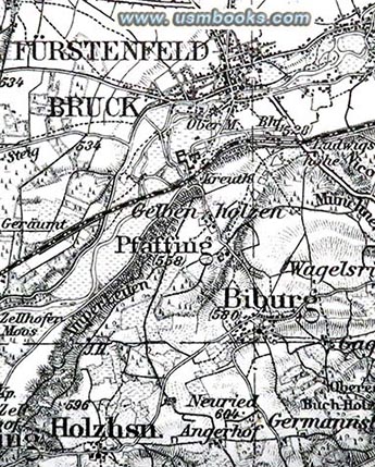
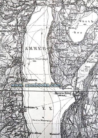
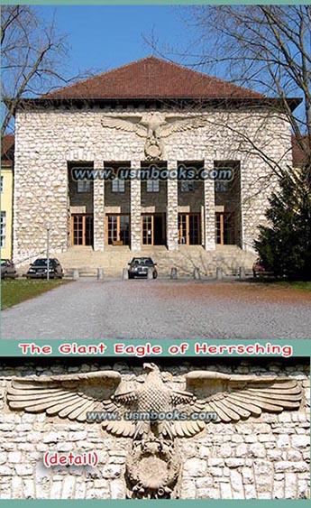
This Nazi map includes towns such as Fürstenfeldbruck (1936 Luftwaffe Air Base / USAF Air Base where Israeli hostages were murdered during the 1972 Olympic Games), Landsberg (where Hitler was imprisoned after the failed 1923 Nazi Putsch), Herrsching (site of the large Nazi Reichssteuerschule or State Tax School- see reference photo right), Diessen on the Ammersee (home of Raumbild-Verlag Otto Schönstein, the publishing house that produced 3D stereo photo albums during the Third Reich), etc.
This particular map is in wonderful condition - no stains, finger prints, tears or holes just a few annotations in pencil. It has clearly been unfolded on very few occasions! The original tan and black cover bearing the huge eagle and swastika is also in very nice condition. It has advertising for other Nazi maps produced by the Reichsamt für Landesaufnahme on the back panel.


Have a look at other original military and civilian Third Reich maps for sale on USMBOOKS.com. We are happy to combine shipping to save you money!
| • IF you prefer faster and safer Priority Mail shipping with USPS Tracking add $7.25. |
| • IF you wish to purchase highly recommended, but optional insurance, add $3.50. |
| • We will be happy to ship abroad at additional cost. Please inquire. |
VERY DETAILED NAZI MAP OF BAVARIA 1940
WITH EAGLE AND SWASTIKA COVER
A BIG SINGLE SHEET MAP
OF PART OF BAVARIA
PRODUCED IN GERMANY
DURING THE THIRD REICH
OF ADOLF HITLER