|
|
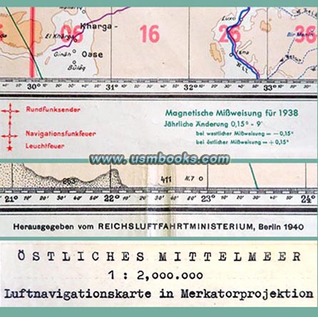
This original Luftnavigationskarte in Merkatorprojektion was published by the Reichsluftfahrtministerium (RLM or German Air Force Ministry) of Hermann Goering in Berlin in 1940. The scale of the 37-½ x 42 inch map is 1=2,000,000. Solid red lines on the map show existing borders in 1940, and it has cities large and small, rivers, lakes and channels, mountain passes and glaciers, railways, etc.
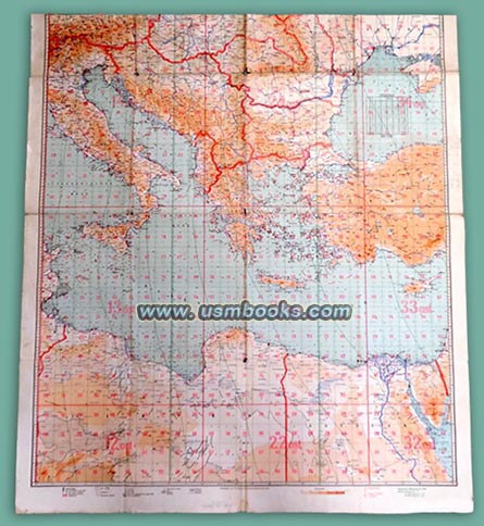
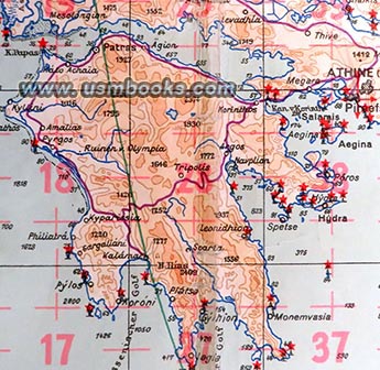
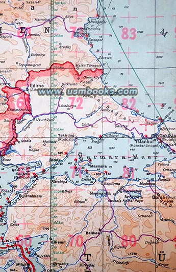
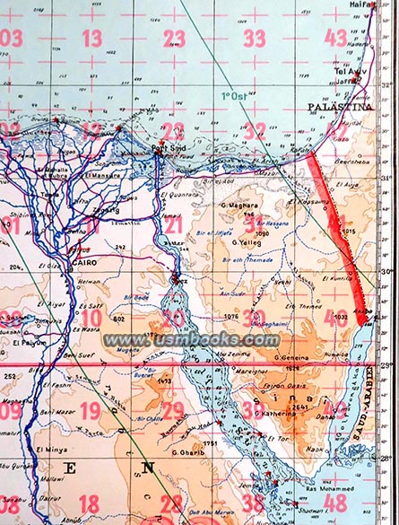
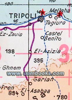
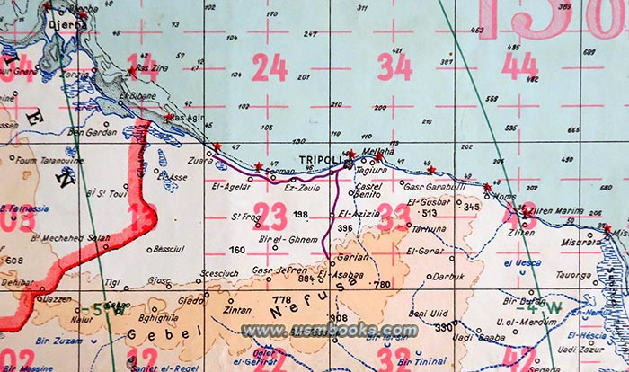
This is a rare original Third Reich 37-½ x 42 inch multi-color Luftwaffe aerial navigation map of the Östlisches Mittelmeer, the eastern part of the Mediterranean Sea. The map covers most of Italy, Sicily, a small part of southern Bavaria (including Garmisch-Partenkirchen), Yugoslavia, southern Hungary, Greece, Rumania, southern Russia, Crimea and the Black Sea, Turkey, Crete and Cyprus, the Sinai Peninsula, northern Egypt, Libya, and eastern Tunisia.
This Luftwaffe map was no doubt produced in anticipation of the Balkanfeldzug, the Nazi Balkan campaign in the spring of 1941 which started with the overwhelming air attack on Belgrade by the German air force, followed by the invasion of Greece and also included Operation Merkur, the famous airborne invasion of Crete by Nazi Fallschirmjäger (paratroopers). This Luft-Navigationskarte also includes Tobruk and El Alamein in northern Africa where the DAK, the German Africa Corps of Field Marshal Erwin Rommel, would become famous a few years after this rare map was produced.
As you can see, the top edge of this 80 year old Luftwaffe color map was cut off. The colors are bright not faded. Some of the folds have small tears, but it has no repairs or tape. No odor. A great original piece of German military and World War II Nazi aviation history.
Have a look at other Nazi maps and aviation material for sale on USMBOOKS.com. We are happy to combine shipping to save you money!
| • IF you prefer faster and safer Priority Mail shipping with USPS Tracking add $9.95. |
| • IF you wish to purchase highly recommended, but optional insurance, add $3.75. |
| • We will be happy to ship abroad at additional cost. Please inquire. |
ORIGINAL 1940 NAZI LUFTWAFFE PILOT COLOR MAP
ITALY, YUGOSLAVIA, GREECE, TURKEY, EGYPT, LIBYA, TUNESIA
LUFT-NAVIGATIONSKARTE IN MERKATORPROJEKTION
EASTERN MEDITERRANEAN 1940